maps

Maps of Dune

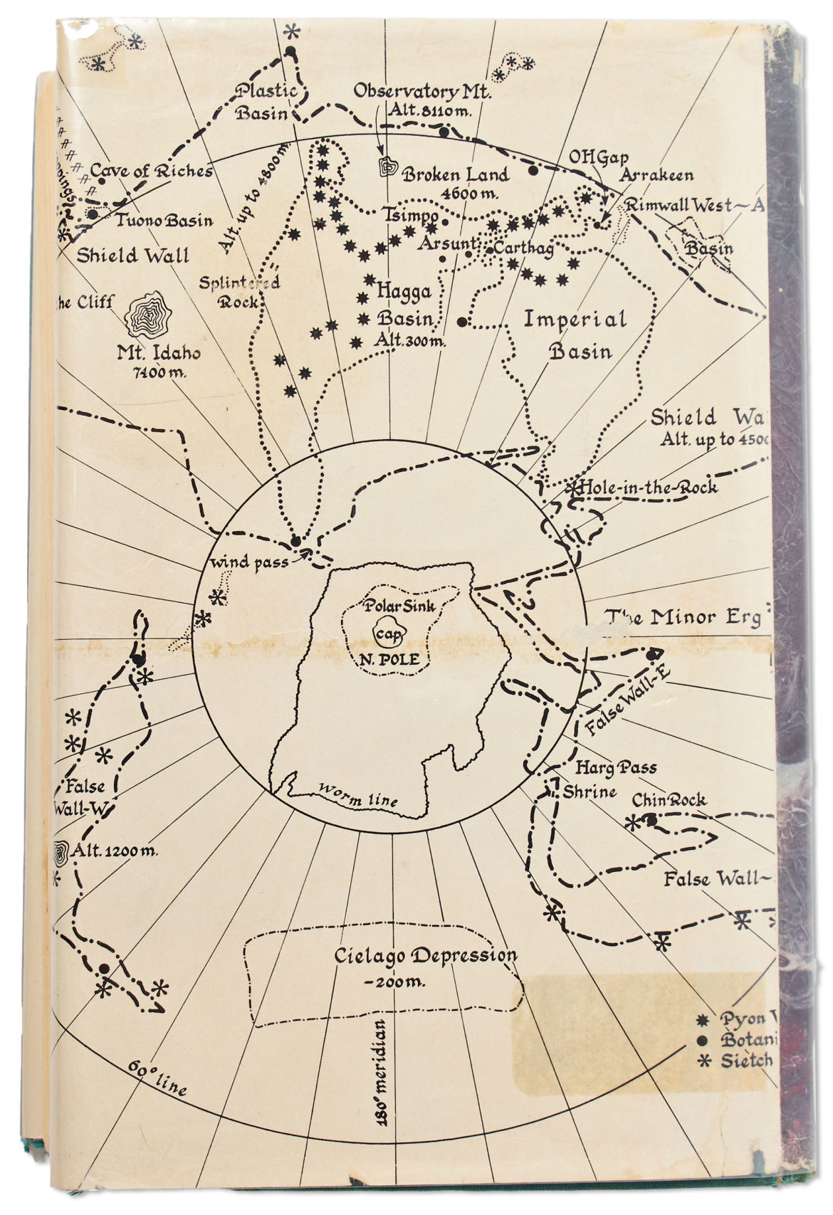
The First edition, first printing of the science fiction classic “Dune” by Frank Herbert has an unusual map of the stories setting printed on the dust jacket. The linked edition had an opening bid of $6,500 but didn’t sell. I haven’t yet read (or watched) Dune but I’m posting this here for when I do.

Dune map

ht: Nelson Minar

After posting this at reddit I was pointed toward these:

See also: The Most Accurate Maps Of Panem

Flooded Google Street View

Flooded street

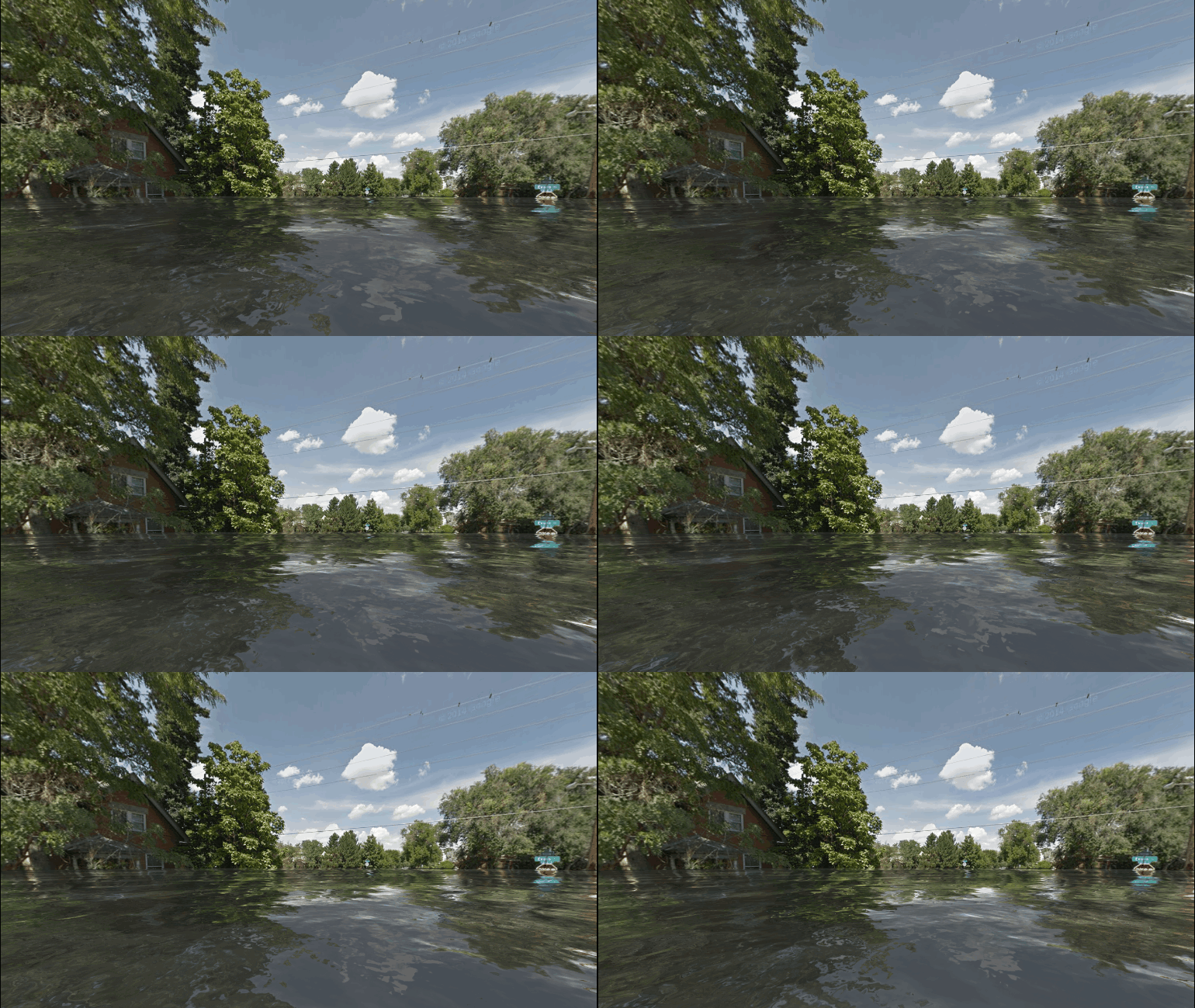
This is what my street could look like according World Under Water. It is a Google Maps powered website (Chrome only) that it lets you pick any Street View location and see what it will look like after sea levels have risen. The site was created to bring awareness to World Environment Day on June 5. Unfortunately it uses the same effect for every location and the sea level doesn’t change depending on your geography. Regardless, it’s an admirable idea and the illusion is fairly believable.

United States Of Electoral Votes

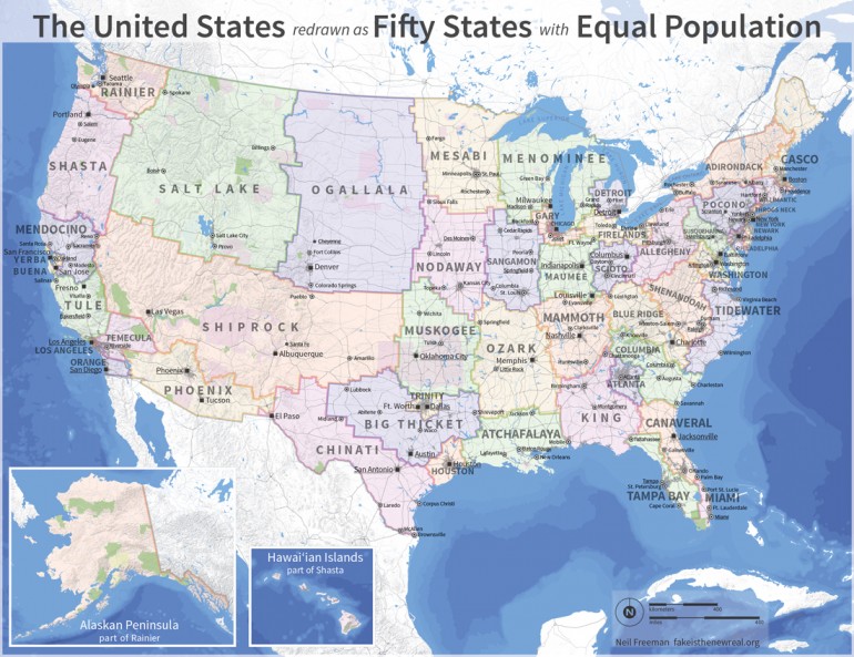
In an unearnest attempt to rethink the electoral college, Neil Freeman redrew the US into 50 new states with equal population. In an effort to reduce the disparity in size and influence of individual states in the current electoral college, Neil Freeman redefined geographical boundaries of all 50 states (and renamed them) so that they each contain a population of about of about 6,175,000. For example California is split into nine states while Colorado gets divided among Shiprock, Ogallala, and Salt Lake.

US Electoral Map

The map began with an algorithm that groups counties based on proximity, urban area, and commuting patterns. The algorithm was seeded with the fifty largest cities. After that, manual changes took into account compact shapes, equal populations, metro areas divided by state lines, and drainage basins. In certain areas, divisions are based on census tract lines.

Keep in mind that this is an art project, not a serious proposal, so take it easy with the emails about the sacred soil of Texas.

via kottke

Historic Vice Maps Of Chicago

The vice maps below were created by Levee historian Bryan Lloyd. They depict all of the bars, dives, brothels, saloons, pool halls and gambling houses in the Levee and Little Cheyenne Districts of Chicago between 1870 and 1923.

Some of my favorite place names include:

  • Rose Lovejoys
  • Bed Bug Row 10¢ Cribs
  • The Badlands
  • Suicide Hall
  • The Morgue
  • Ike The Jew
  • Blubber Bob Gray’s “The California”
  • Dreamland
  • Bucket Of Blood

Hunger Games: The Most Accurate Maps Of Panem

Bloggers aimmyarrowshigh and badguys have created this exceptionally accurate map of Panem, the world created by Suzanne Collins in her series “The Hunger Games“. Panem is described being a North America that has been ravaged by war and geological catastrophes.

“The result was Panem, a shining capitol ringed by thirteen districts, which brought peace and prosperity to its citizens. Then came the Dark Days, the uprising of the districts against the Capitol. Twelve were defeated, the thirteenth obliterated.”
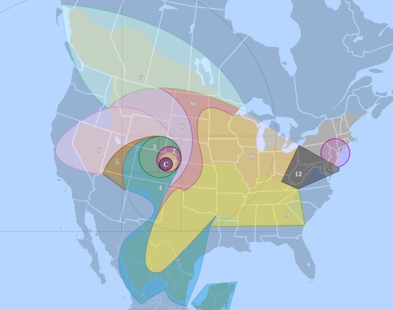
Map Of Panemimage courtesy of badguys and aimmyarrowshigh
Click the map. It’s massive. And well thought out. Its creators took into consideration all sorts of information from the books, including:

  • The Capitol is in Denver.
  • D12 is Appalachia.
  • D11 shares a border with D12, is one of the largest districts, is South of D12, and is primarily used for growing grain and produce.
  • D10 is primarily used for raising livestock. They do NOT process the livestock in D10. However, to feed an entire nation, D10 is likely another very large District.
  • D9 processes food for the Capitol and the tesserae; therefore, it likely shares borders with the food production Districts (D4, D10, D11).
  • D8 produces and treats textiles and is a factory District. It is POSSIBLE to reach D12 from D8 on foot over a course of weeks/months. Therefore, it does not cross a large body of water.
  • D7 specializes in lumber. It’s probably large. It has no role in food processing or manufacture.
  • D6 works closely with the Capitol in the research and manufacture of drugs (morphling, medicines). It likely has close ties to D5 in the production of mutts.
  • D5 is entirely dependent on the Capitol, so it’s probably somewhat nearby, and specializes in genetic research and manipulation. Because of the necessity of creative thought and intellect, it’s most likely a smaller District so that it’s easier to monitor and control.
  • D4 is the ocean. It does have a role in food production. It’s very large. It is a Career District, so it likely is near the Capitol and has some self-sufficiency, but not enough that it doesn’t engender loyalty. (Aside from that, D4 = perfect.)
  • D3 has extremely close ties to the Capitol and works with electronics and technology. It is likely small, the Capitol can closely monitor its scientific minds. It has no role in food manufacture or processing.
  • D2 specializes in weaponry, is the most loyal District (because the Capitol needs to keep its weapon specialists happy, non?), and has no role in food production. D2 also works in some minor Mining elements and trains Peacekeepers. The Panem railroad is easily accessible in D2.
  • D1 produces luxury goods for the Capitol — INCLUDING having a diamond mine. Kelsey Lake Diamond Mine is a defunct diamond mine in Colorado, USA. It is located in the State Line Kimberlite District, near the Wyoming border.
  • D13 specialized in nuclear power, shares a border with D12, is both visible and reachable from D12 by foot, and is North of West Virginia. Three Mile Island was in New York Pennsylvania, and probably remained a nuclear reactor or was co-opted again as a reactor. D13 is small but mighty and is surrounded by Wilderness. It is self-sufficient.

This information was combined with some speculation about the results of future cataclysmic natural disaster in order to reach the maps final result. Of course, to me, the most interesting aspect of the map is the Capitol is located in what is now Denver, Colorado. I like the idea of Denver being the future capital of the post-apocalyptic dystopia.

Additionally, I would be remiss to not include Nerd Friday’s version of the Panem map shown below. This arguably more accurate map places the Capitol near Grand Junction, Colorado. More information about Nerd Friday’s creation process can be found in the bibliography and referenced works as well as the frequently asked questions section.
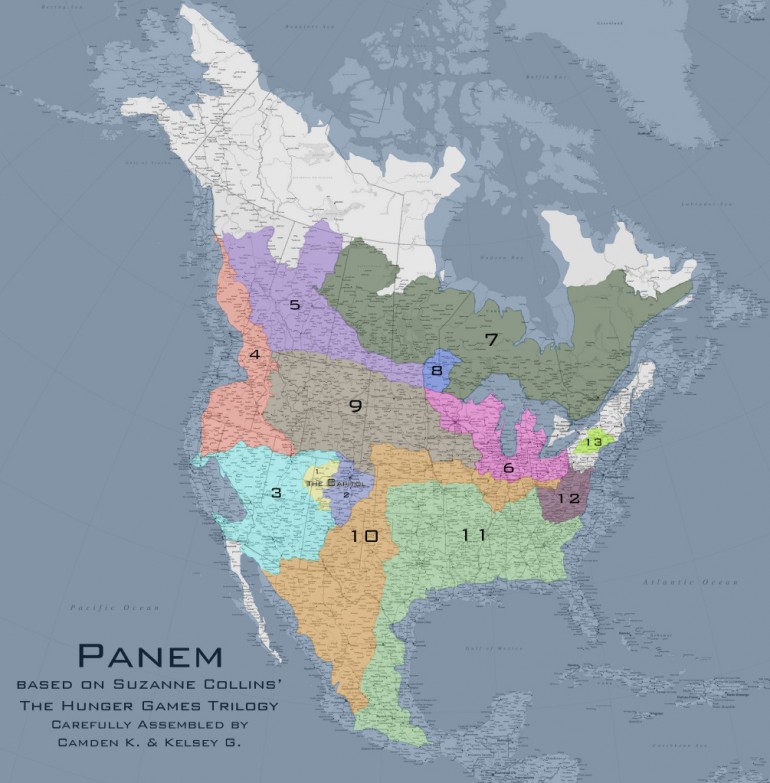
Map of Panem

Maps Of City Skylines

New York City Skyline Map
Map courtesy of Andy Woodruff

A few weeks ago, Eric Fischer put together a set of maps that attempted to compare the areas of a city that were most often photographed by locals versus the areas most often photographed by tourists. A look through the maps of 60 different cities shows concentrations of web-posted tourist pictures in museums, parks, historic sites, architectural marvels, etc. Other (more) interesting areas of the city are filled in by photographs from the locals.

Another cartography tool to add to your travel-photography-belt are Andy Woodruff’s maps depicting the best areas to photograph a city’s skyline (as defined by photos tagged “skyline” on Flickr). They were put together in a sort of heat map style where brighter red and yellow marks indicate a higher density of photos (and presumably a superior view of the skyline). His blog has maps of several cities, including Boston, Seattle, Vancouver, and Chicago, among others.

Unfortunately, neither Eric’s tourists maps nor Andy’s skyline maps contain locations in Denver.

Deepwater Horizon Oil Spill In Denver

How big is the Deepwater Horizon Oil Spill?

On April 20th, an explosion on the Deepwater Horizon left 17 workers injured and 11 missing and presumed dead. Oil is spilling from a well 5000 feet below sea level, discharging 200,000 gallons of crude oil a day according to the official estimate. It is estimated that more than 6 million gallons of crude oil have spewed into the Gulf so far.

It is understandably difficult to imagine how large this spill actually is. The picture above shows the area the spill would cover if it had originated in Denver. It would stretch from Fort Collins to Colorado Springs and as far east as Hillrose. Want to see the spill size compared to you city? Check out Paul Rademacher’s website.

UPDATE: If It Was My Home also does a great job of mapping the spill and overlaying it onto your hometown

Scroll to Top